Grid-based 3DMA GNSS with clustering and Doppler velocity using factor graph optimisation

Ng, H. F., Zhong, Q., Groves, P., Hsu, L. T.

The Journal of Navigation (2025)

journal Q1 精選頁面
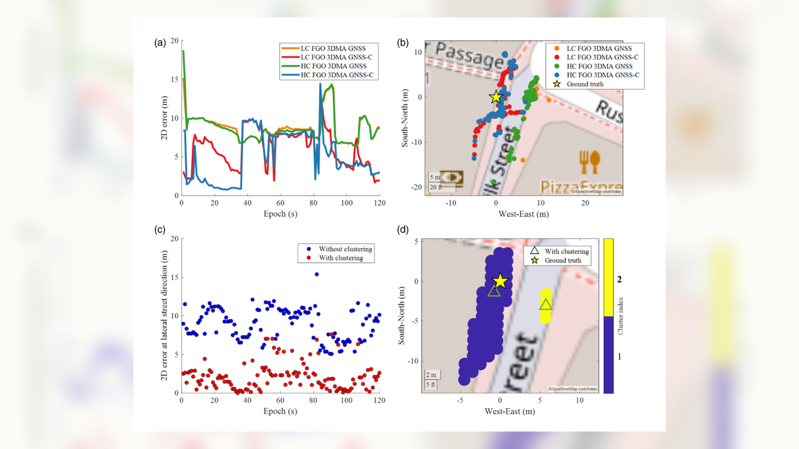
vehicular 3DMA GNSS experiment 的 clustering 與 trajectory panels。
圖 7 視覺細節:vehicular 3DMA GNSS experiment 的 clustering 與 trajectory panels。

摘要

這篇 grid-based 3DMA GNSS 論文把候選點 clustering、Doppler velocity 與 factor graph optimization 串在一起,用於改善深度城市場景中的 GNSS 定位。

重點

  • 論文先以 region-growing clustering 分離多峰的 3DMA GNSS 候選位置,再進入 factor graph optimization。
  • 實驗涵蓋 London 靜態資料與 Canary Wharf 車載資料,並比較 loosely coupled 與 hybrid-coupled FGO 版本。

圖像

在候選點分數計算後,論文用 region growing 把可能的位置分成不同 clusters,而不是強迫所有候選點形成單一解。
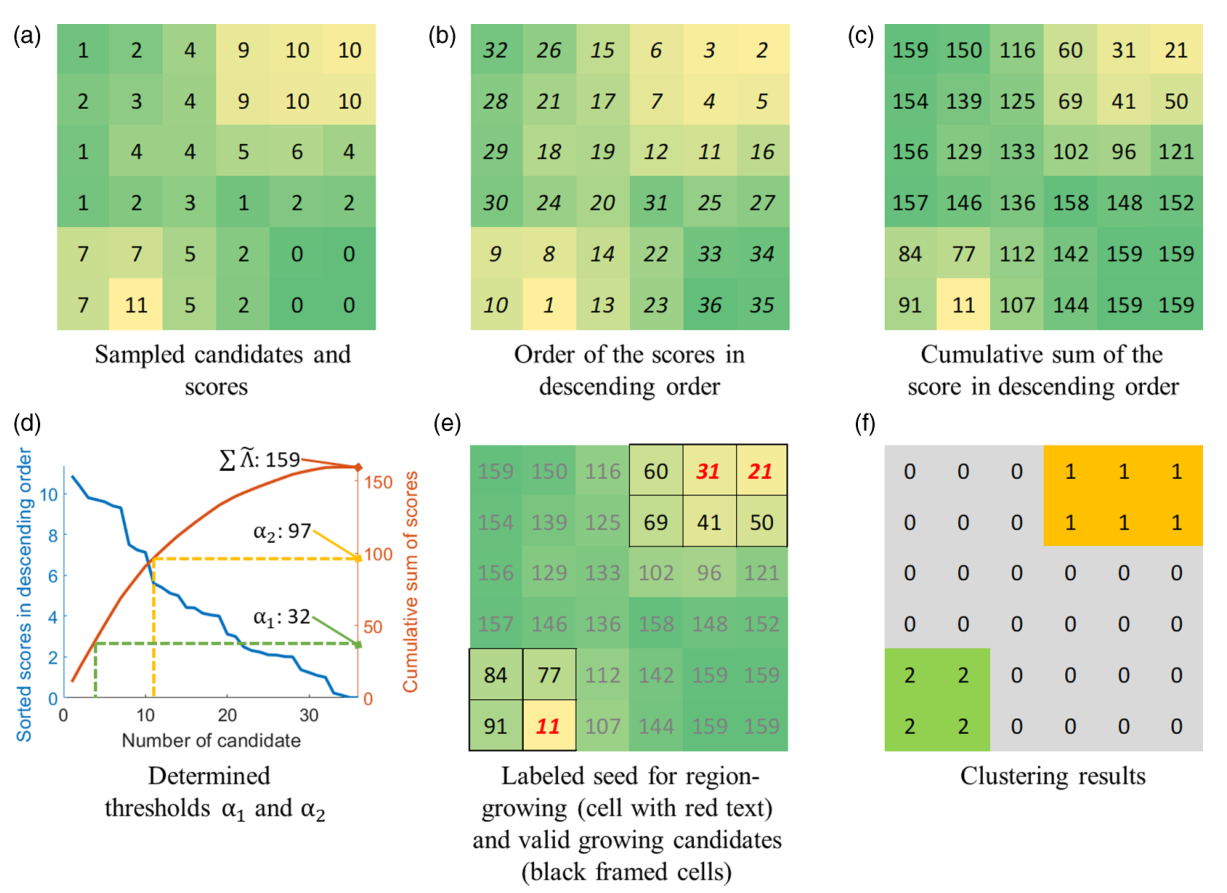
以 sampled candidates、score ordering、thresholds 和 clustering results 說明 region-growing 的簡化範例。
圖 2:用於 clustering 3DMA GNSS sampled candidates 的 region-growing 簡化範例。

選出的 cluster 接著成為 hybrid-coupled graph 中的 measurement factor,並與 pseudorange 和 Doppler 資訊一起約束定位。
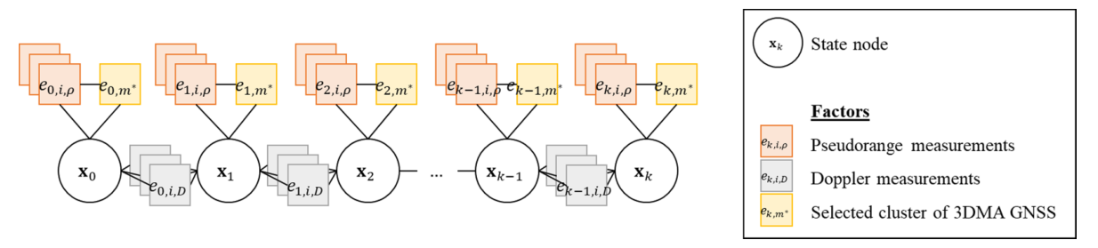
包含 state nodes、pseudorange factors、Doppler factors 與 selected 3DMA GNSS cluster factors 的 hybrid-coupled factor graph。
圖 4:proposed hybrid-coupled 3DMA GNSS approach 的 factor graph 結構。

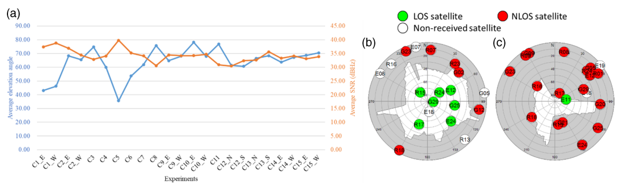
在呈現定位精度前,論文先交代實驗中的城市遮蔽程度與衛星可見性條件。

顯示 building-boundary elevation angle、SNR、LOS satellites 與 NLOS satellites 的實驗統計與 sky masks。
圖 5:代表性測試點的平均 building-boundary elevation、received SNR 與 sky masks。

靜態結果顯示 clustering 能降低沿街方向誤差,並把真值附近的候選 cluster 與其他 cluster 分開。
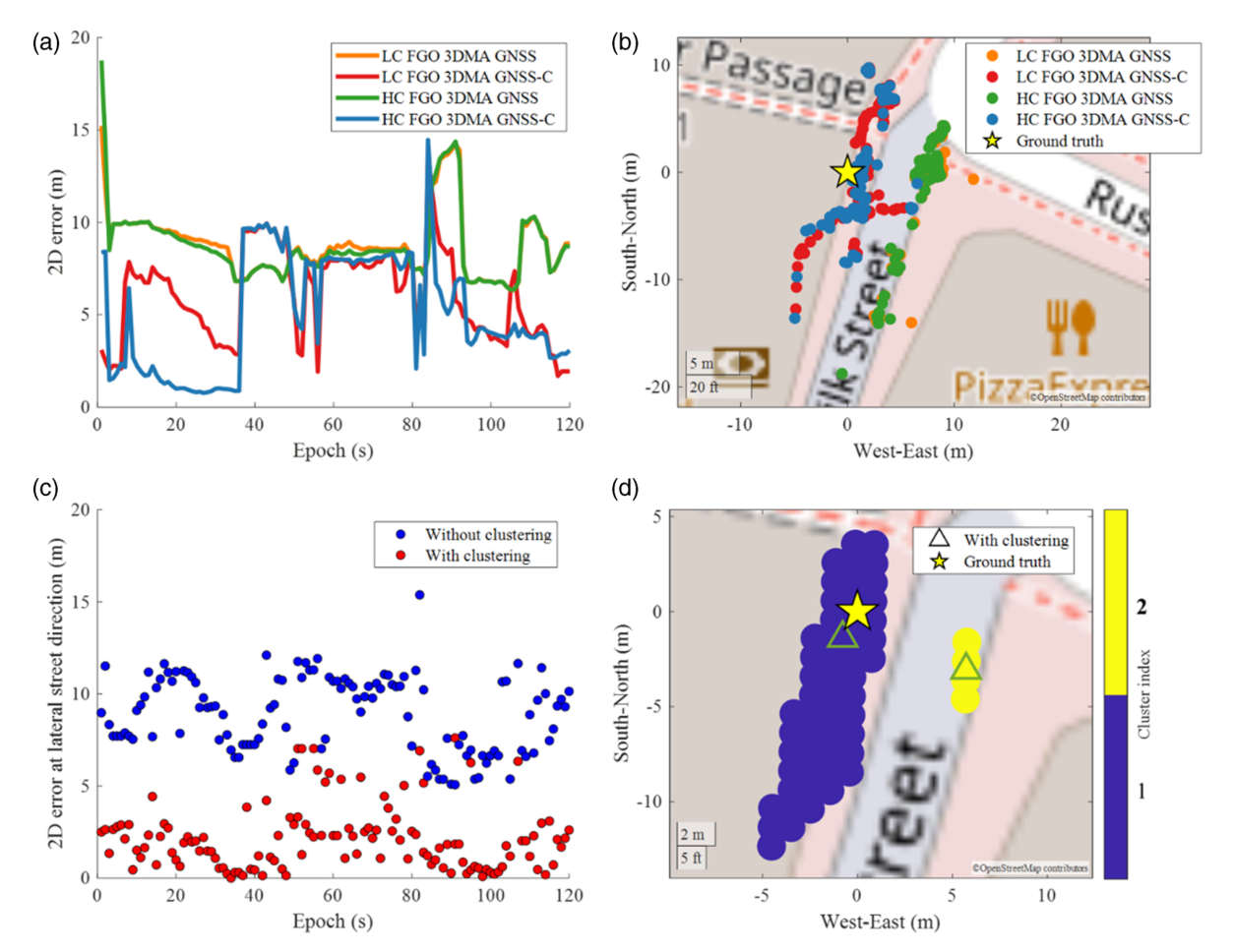
在困難街谷位置比較 clustered 與 non-clustered 3DMA GNSS FGO 方法的靜態定位結果圖。
圖 7:靜態城市測試點的 horizontal errors、map plots 與 multiple-cluster 範例。

車載結果把靜態觀察延伸到動態路線,並比較 conventional、grid-filter 與 FGO-based 方法的誤差分布。
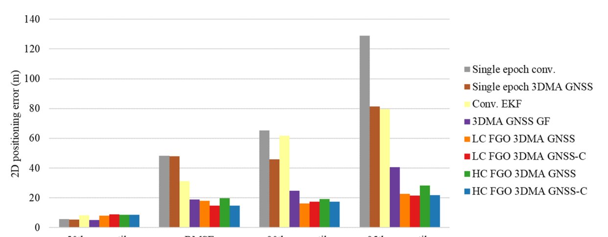
比較不同演算法在車載實驗中的 RMSE、50th、90th 與 95th percentile 定位誤差的柱狀圖。
圖 9:車載實驗中的 RMSE 與 horizontal radial positioning error percentiles。