Hong Kong UrbanNav: An open-source multisensory dataset for benchmarking urban navigation algorithms

Hsu, L. T., Huang, F., Ng, H. F., Zhang, G., Zhong, Y., Bai, X., Wen, W.

NAVIGATION: Journal of the Institute of Navigation (2023)

journal Q1 精選頁面
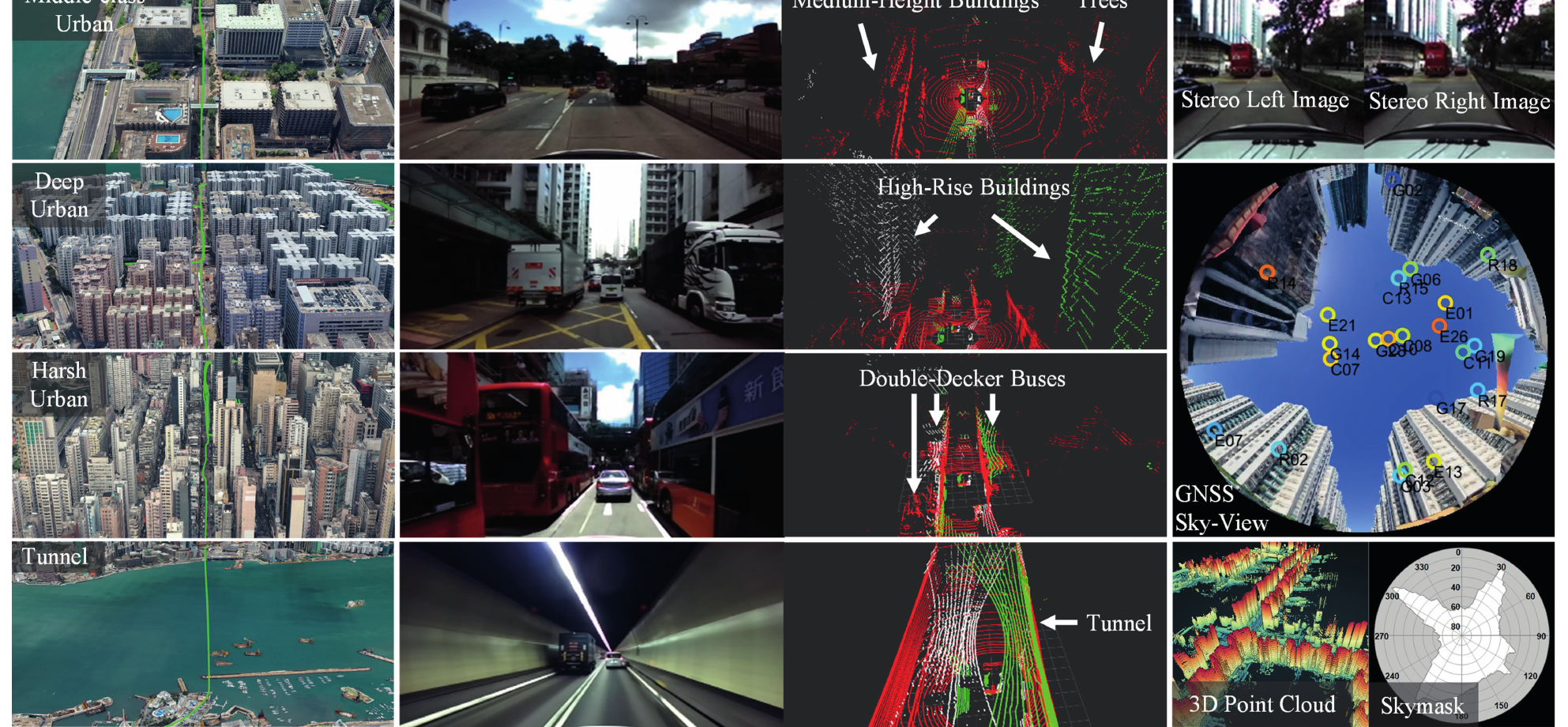
Overview montage of the UrbanNav dataset, including Hong Kong urban scenes, vehicle sensors, LiDAR point clouds, GNSS sky-view imagery, and skymasks.
圖 1(UrbanNav 論文):多感測器資料和具有挑戰性的香港城市場景,用於導航基準測試。

影片

圖像

資料集故事從實體採集平台開始,展示 GNSS、IMU、LiDAR 和相機如何一起搭載。
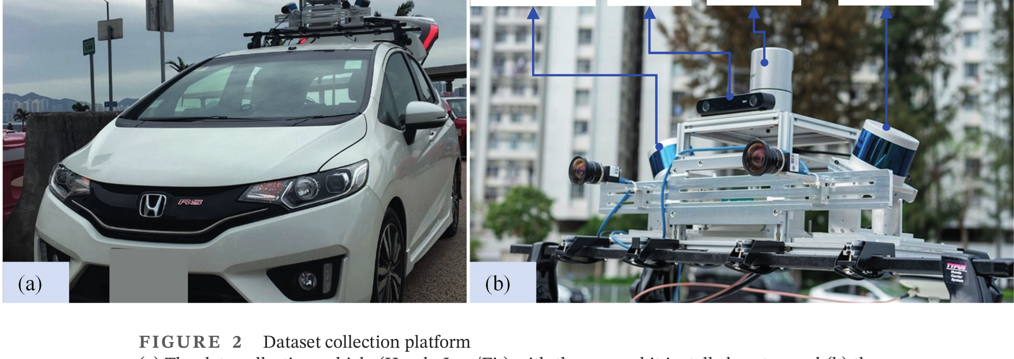
UrbanNav data collection vehicle and roof-mounted sensor kit with GNSS, IMU, LiDAR, and cameras.
圖 2:資料採集平台和整合多感測器套件。

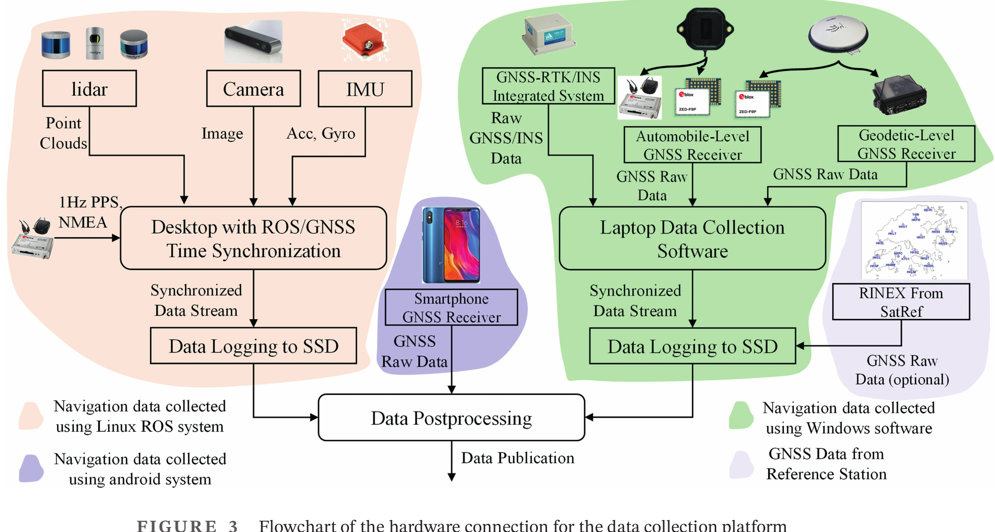
這進一步把感測器平台轉化為同步記錄流程,用於採集對齊的多感測器資料。

Hardware connection flowchart for synchronized UrbanNav sensor logging and postprocessing.
圖 3:資料採集平台的硬體連接與同步流程。

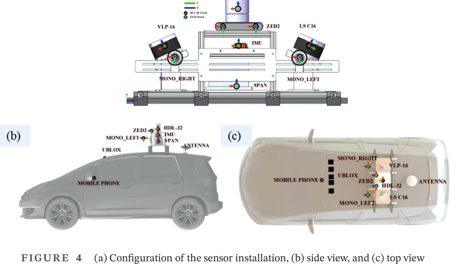
安裝幾何關係提供了把不同感測器資料流一起使用所需的校準基礎。

Sensor installation drawing with rack configuration, side view, and top view.
圖 4:UrbanNav 車輛的感測器安裝校準幾何。

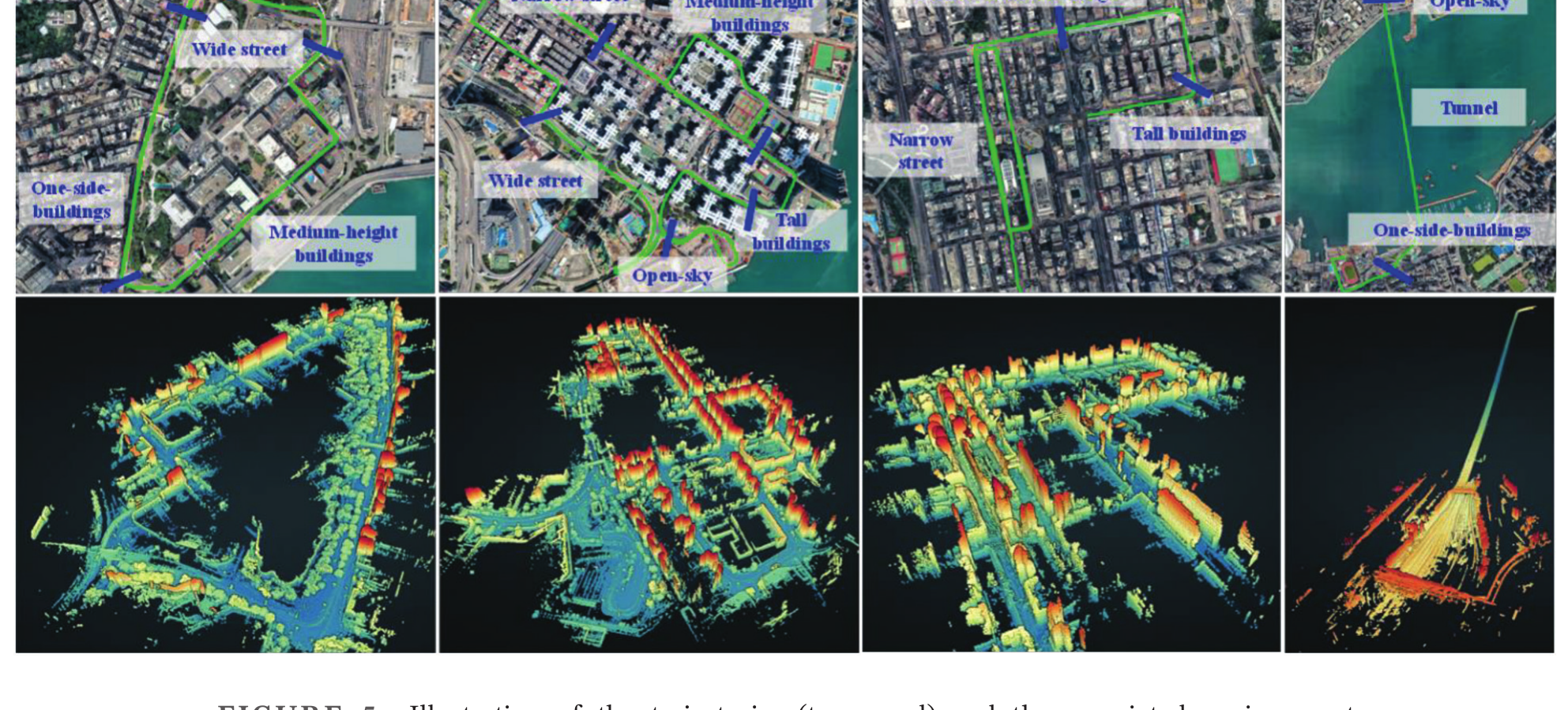
在平台定義完成後,論文介紹資料集要用於基準測試的城市場景。

UrbanNav scenario trajectories and environment reconstructions for middle-class, deep, harsh, and tunnel urban cases.
圖 5:四個選定資料集的代表性軌跡和重建環境。

天空遮罩量化這些場景對衛星的遮擋,把環境嚴重程度與 GNSS 難度連結起來。
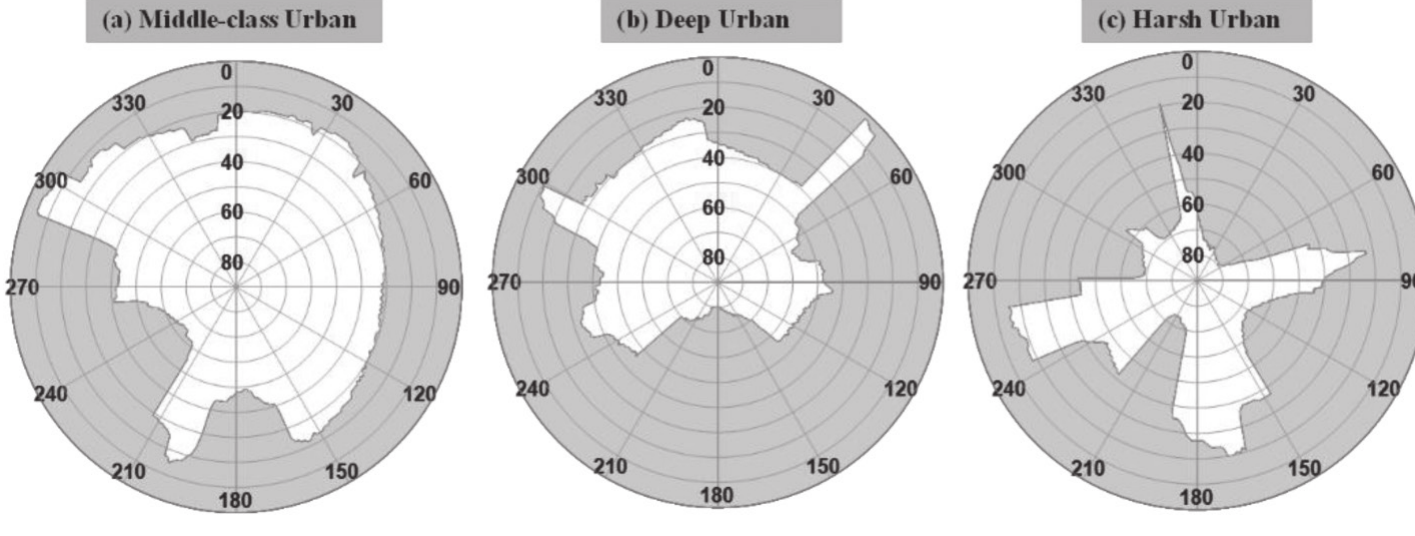
Skymask examples for middle-class urban, deep urban, and harsh urban scenarios.
圖 6:用於描述城市峽谷中衛星可見性約束的天空遮罩示例。

基準測試部分隨後在選定場景中把視覺慣性和 SLAM 演算法與真值軌跡進行比較。
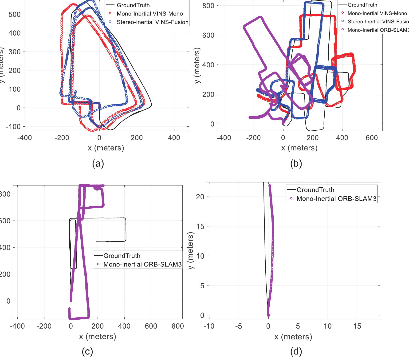
Benchmark trajectories comparing ground truth with VINS-Mono, VINS-Fusion, and ORB-SLAM3.
圖 16:將視覺慣性和 SLAM 方法與真值軌跡比較的基準軌跡。

最後一張圖把公開資料集發布與採集、同步和社群重複使用中的實務經驗連結起來。

Lessons learned montage for UrbanNav, including sensor interference, start point, timing synchronization, and GitHub usage map.
圖 18:採集和發布 UrbanNav 資料集得到的經驗總結。