GLIO: Tightly-coupled gnss/lidar/imu integration for continuous and drift-free state estimation of intelligent vehicles in urban areas

Liu, X., Wen, W., Hsu, L. T.

IEEE Transactions on Intelligent Vehicles (2023)

journal Q1 精選頁面
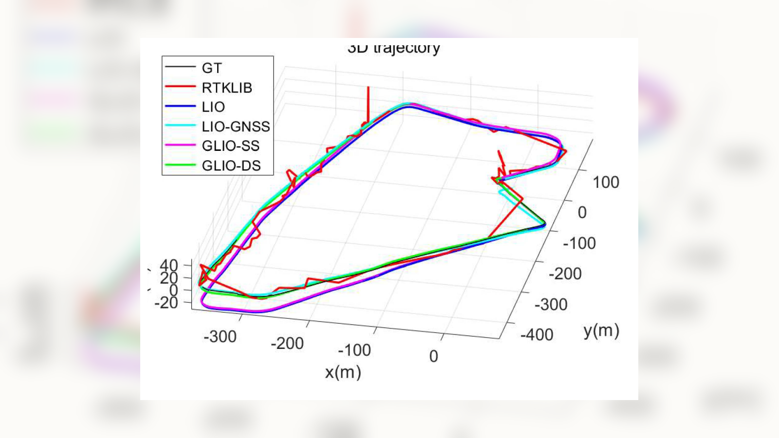
GLIO 與其他 GNSS、LiDAR、IMU integration methods 的 3D trajectory 對比。
圖 4 視覺細節:GNSS、LiDAR 與 IMU integration methods 的 3D trajectory 對比。

圖像

在系統流程之後,這張圖解釋 LiDAR 約束設計如何支持更平滑且更具全域一致性的最佳化。
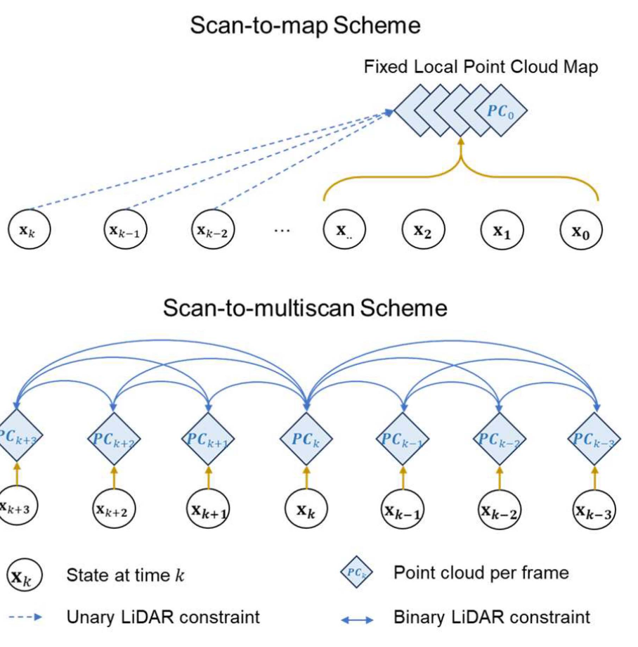
Scan-to-map and scan-to-multiscan LiDAR association schemes.
圖 2:透過 scan-to-map 和 scan-to-multiscan 方案建立 LiDAR 因子關聯。

因子圖展示 GNSS、Doppler、IMU 和 LiDAR 約束如何組織到第一階段和第二階段最佳化中。
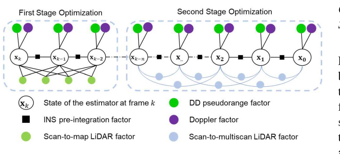
Two-stage factor graph structure with GNSS, INS, Doppler, scan-to-map, and scan-to-multiscan factors.
圖 3:第一階段融合與第二階段最佳化的因子圖結構。

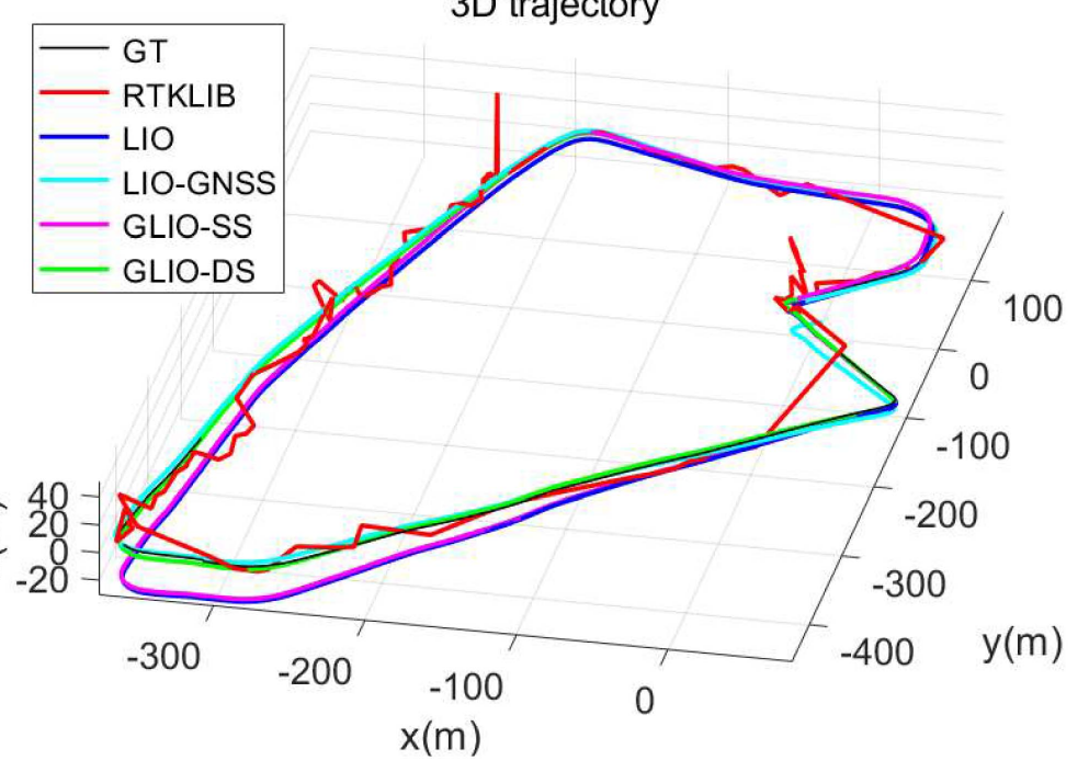
結果從尖沙咀序列開始,比較 GLIO 變體和基線方法的軌跡一致性。

3D trajectory comparison in the Tsim Sha Tsui sequence.
圖 4:RTKLIB、LIO、LIO-GNSS、GLIO-SS 和 GLIO-DS 在尖沙咀的軌跡比較。

這些誤差圖量化同一序列,並顯示鬆耦合系統退化的位置以及緊耦合融合帶來的改進。
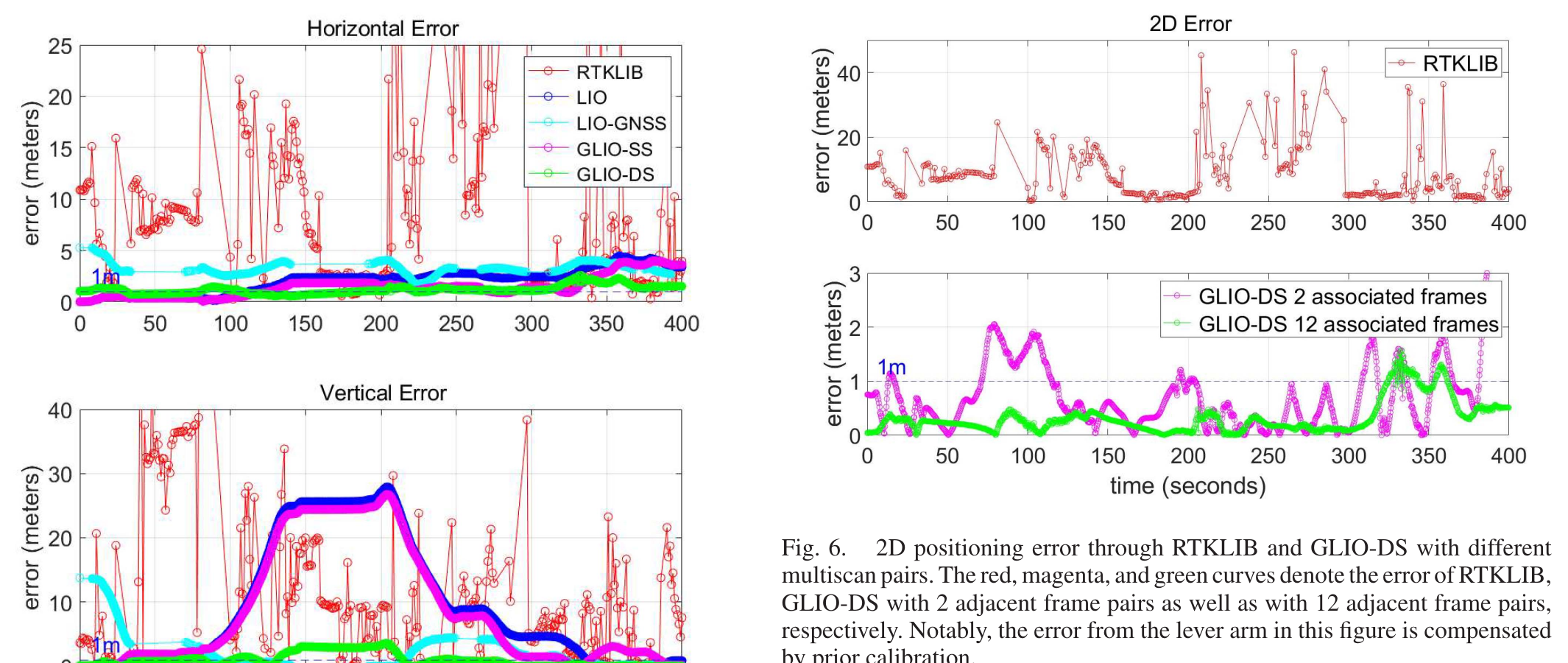
Tsim Sha Tsui positioning error plots comparing GLIO variants and baselines.
圖 5 和圖 6:尖沙咀定位誤差和 scan-to-multiscan 幀比較。

黃埔案例把評估擴展到更長的密集城市駕駛,包含隧道、交通和嚴峻的 GNSS/LiDAR 挑戰。
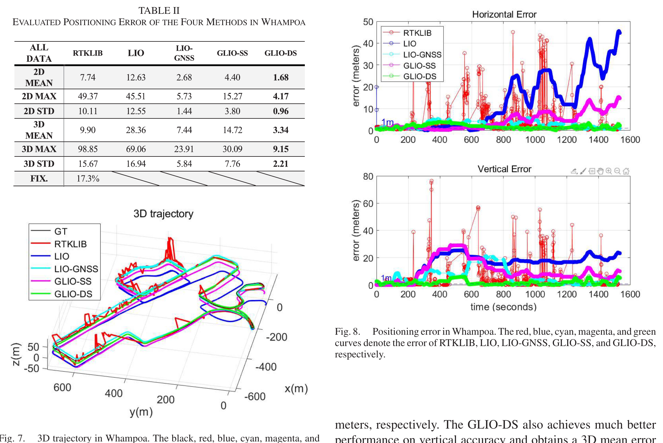
Whampoa table, trajectory, and positioning error plots for GLIO and baseline methods.
圖 7 和圖 8:黃埔密集城市駕駛下的軌跡和誤差結果。