

PositionNet: CNN-based GNSS positioning in urban areas with residual maps
Applied Soft Computing (2023)
Summary
PositionNet uses CNNs and residual maps to learn urban GNSS position corrections.
Figures
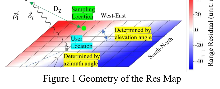
Before the CNN architecture, the paper defines how satellite range residuals become image-like maps around the least-squares solution.
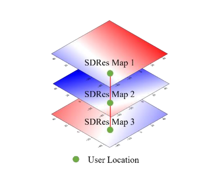
The SDRes map removes receiver clock bias by differencing with a master satellite, creating a clearer location pattern for the network.
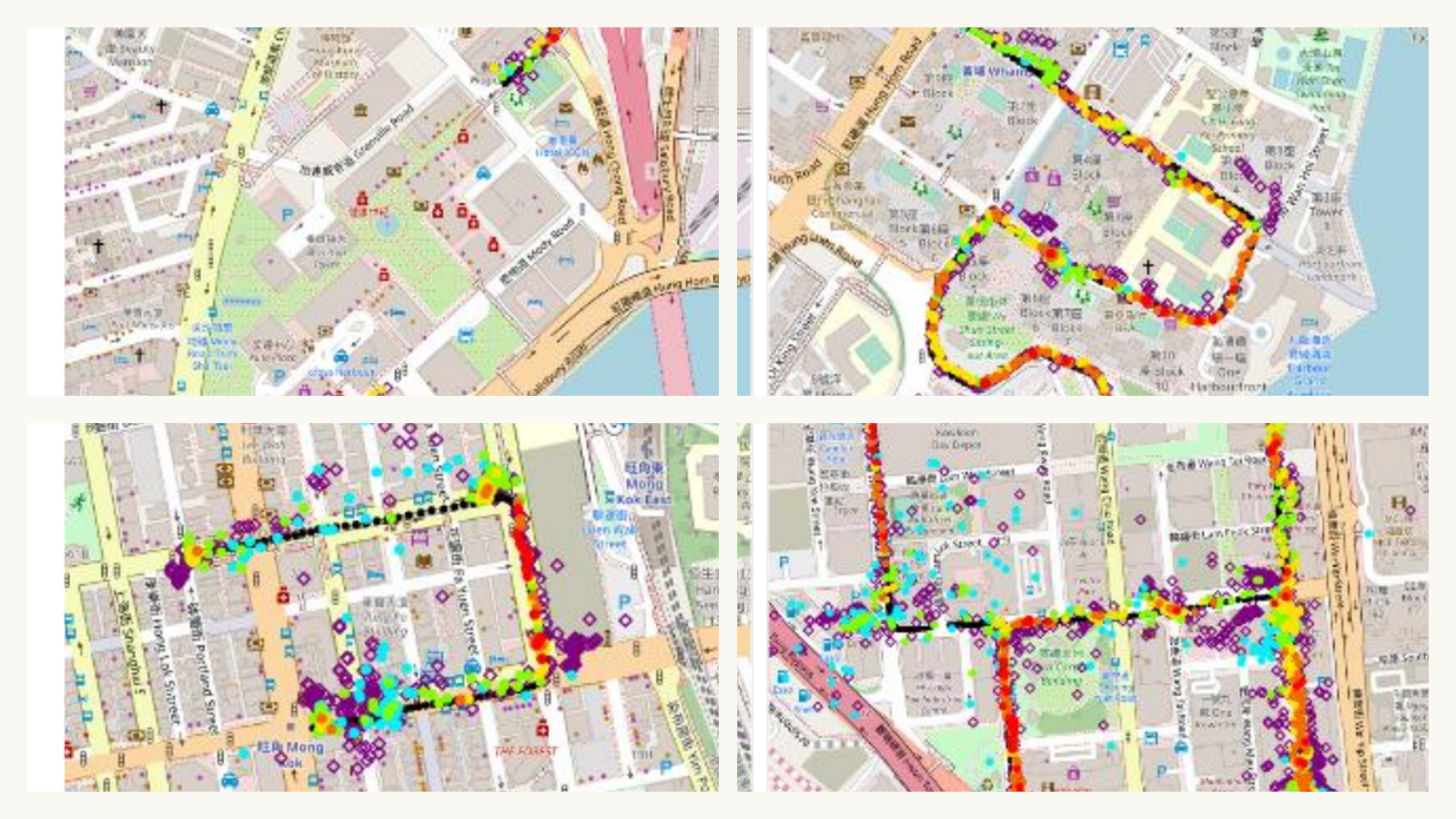
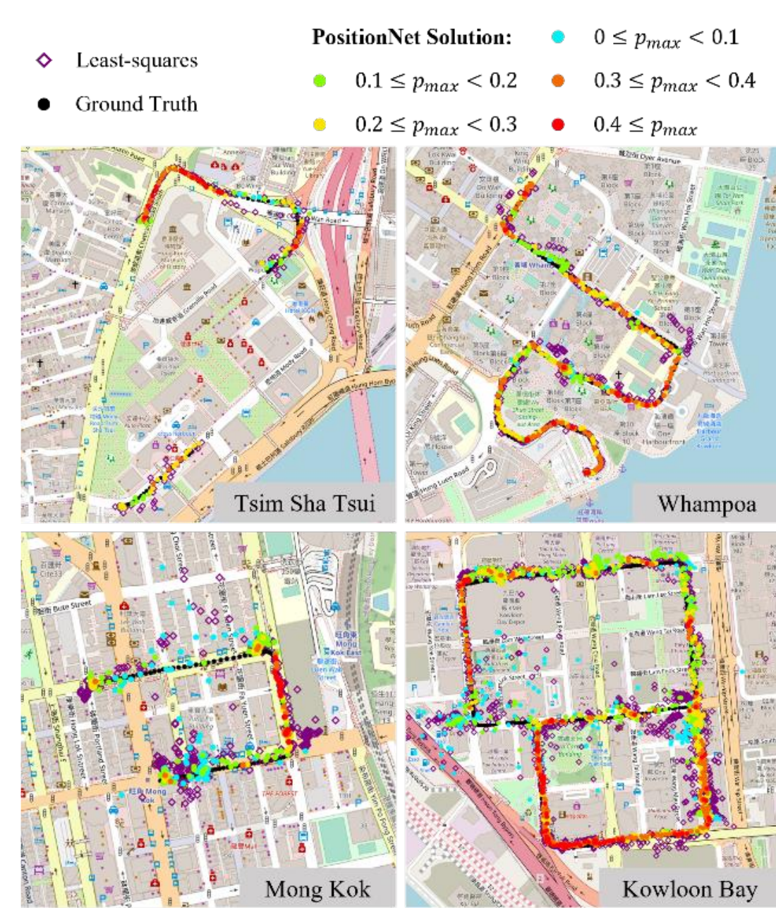
The first result maps PositionNet outputs across urban districts to show validation and testing behavior beyond a single scene.
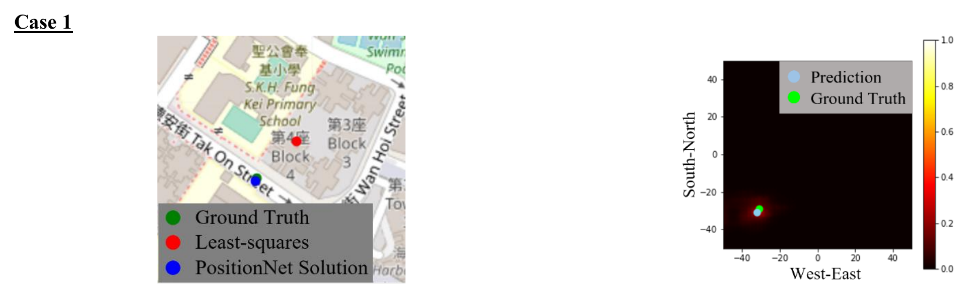
The case study then zooms into one large least-squares error to show how the output heat map points to a corrected location.
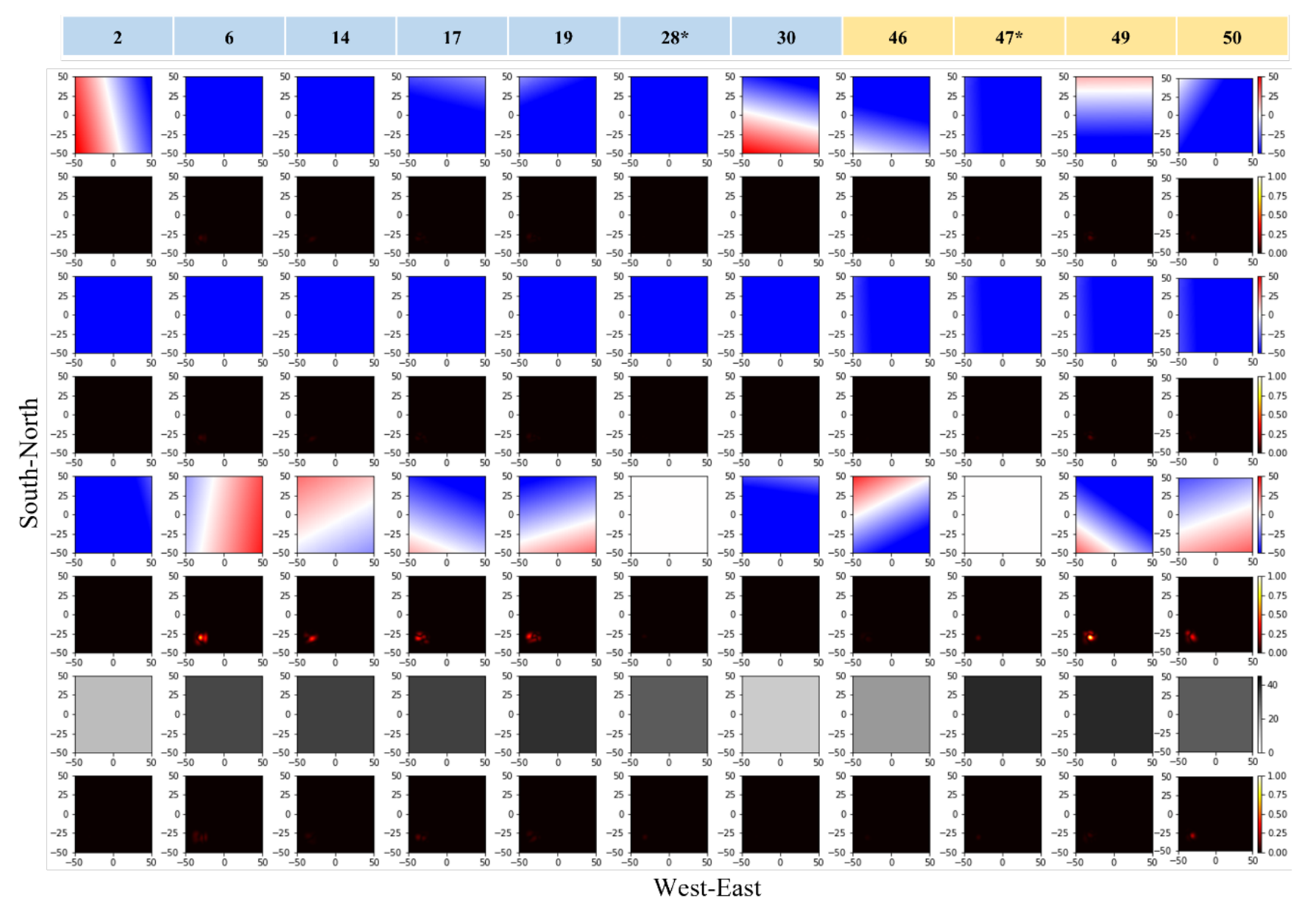
The saliency maps explain that case by showing which satellite residual, SDRes, and C/N0 layers influenced the network.
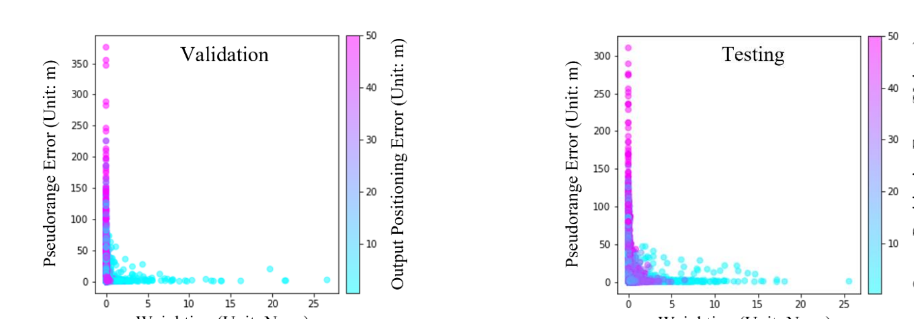
The aggregate saliency plot ties the case-level explanation back to measurement quality across validation and testing data.
Key idea. PositionNet learns to correct urban GNSS errors with a CNN that reads residual maps — turning the spatial pattern of pseudorange residuals into a learned position correction.
Impact. Shows that data-driven methods can complement model-based 3D-mapping-aided GNSS, an early thread in the lab’s AI-for-positioning direction.