

Hong Kong UrbanNav: An open-source multisensory dataset for benchmarking urban navigation algorithms
NAVIGATION: Journal of the Institute of Navigation (2023)
Summary
Open multisensory GNSS, LiDAR, camera, and IMU benchmark captured in Hong Kong urban canyons.
Videos
Figures
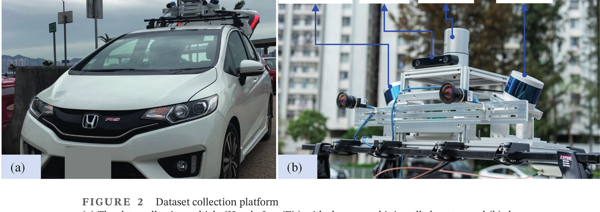
The dataset story starts from the physical collection platform that carries GNSS, IMU, LiDAR, and camera sensors together.
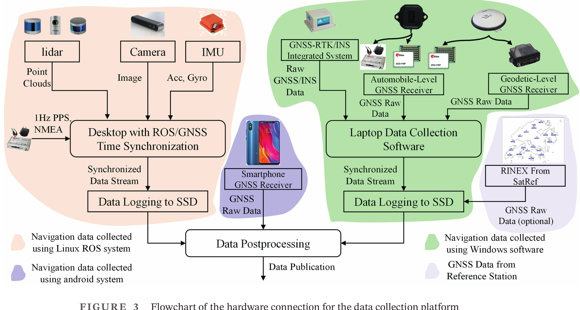
This turns the sensor platform into a synchronized logging pipeline for collecting aligned multisensor data.
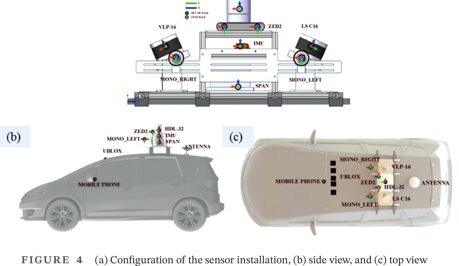
The installation geometry provides the calibration basis needed to use the different sensor streams together.
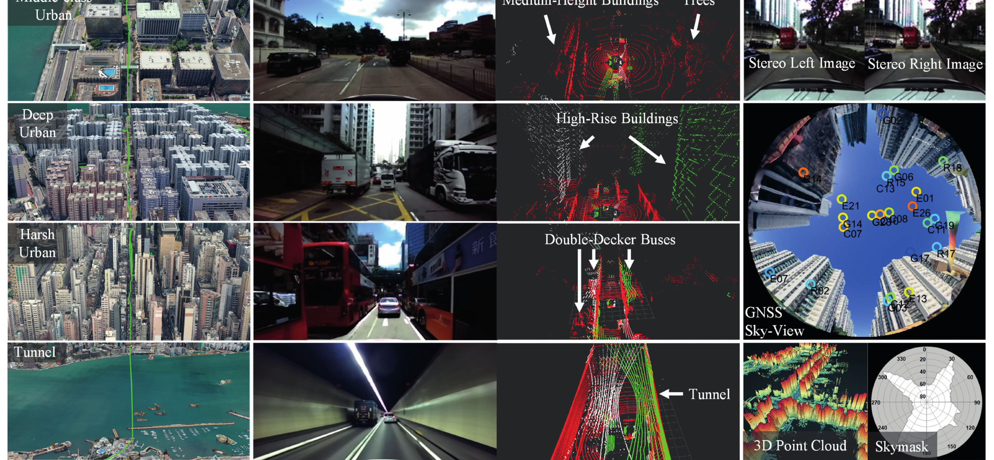
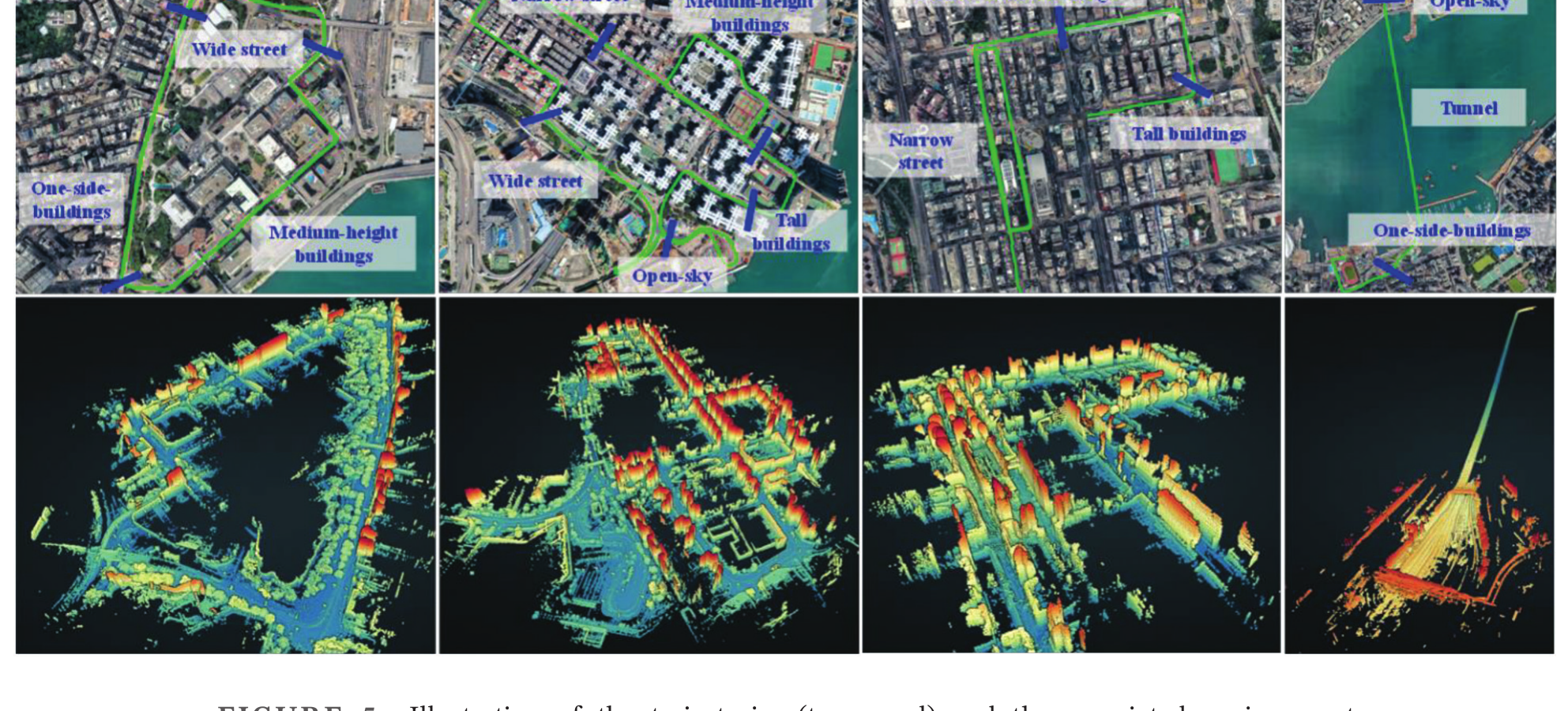
After the platform is defined, the paper introduces the urban scenarios that the dataset is designed to benchmark.
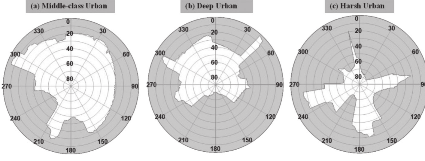
The skymasks quantify how those scenarios obstruct satellites, connecting environment severity to GNSS difficulty.
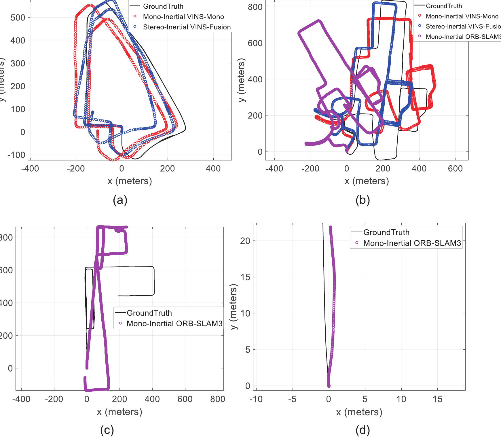
The benchmark section then runs visual-inertial and SLAM algorithms against ground truth across the selected scenarios.
The final figure connects the public dataset release to practical lessons from collection, synchronization, and community reuse.

Key idea. A high-quality open-source multi-sensor dataset (GNSS, LiDAR, camera, IMU) captured in Hong Kong’s deep urban canyons, with accurate ground truth — purpose-built for benchmarking urban navigation algorithms.
Impact. UrbanNav has become a widely used community benchmark for urban GNSS and sensor-fusion research, lowering the barrier for groups worldwide to test in genuinely challenging conditions. Community-facing infrastructure, not just a paper.