

Robust GNSS Shadow Matching for Smartphones in Urban Canyons
IEEE Sensors Journal (2021)
Summary
Robust shadow matching compares smartphone satellite visibility against a 3D building model to improve urban canyon positioning.
Figures
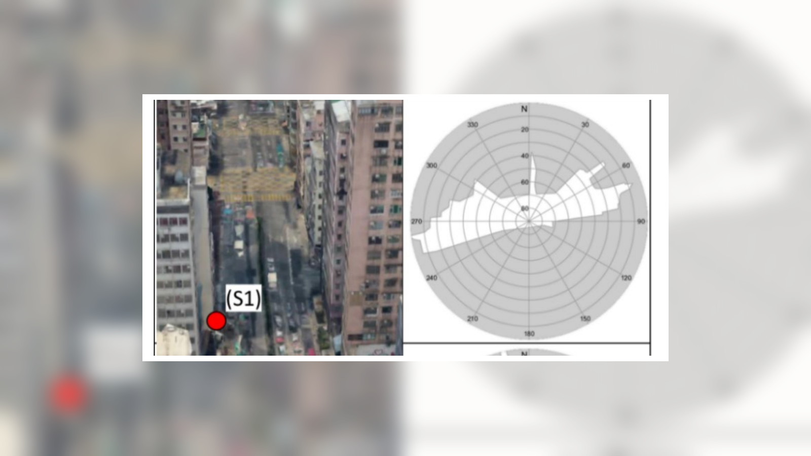
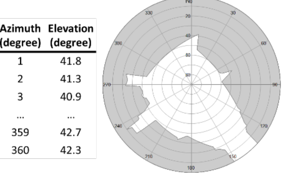
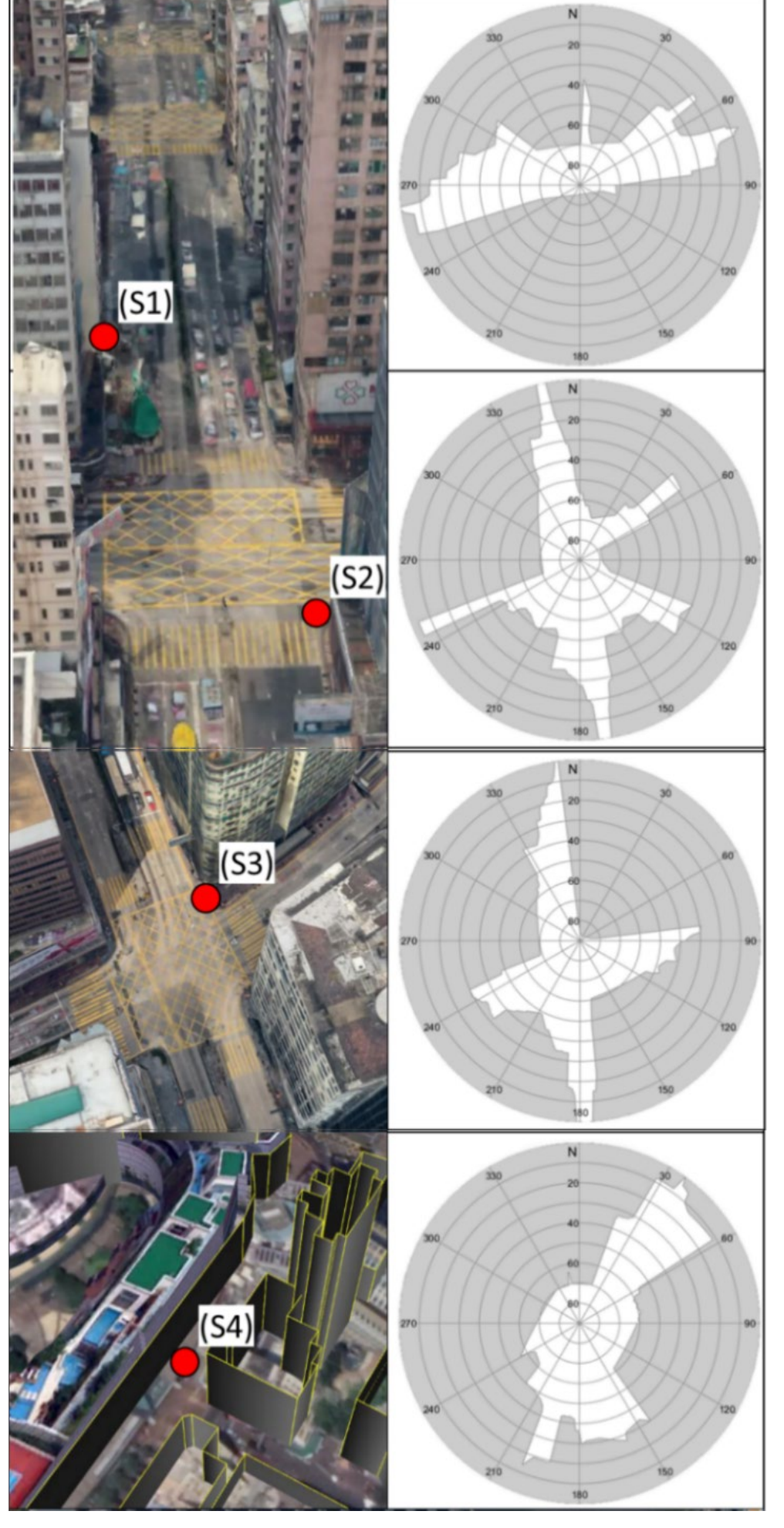
Before scoring candidate positions, the paper defines the skymask representation used to predict LOS and NLOS visibility from 3D buildings.
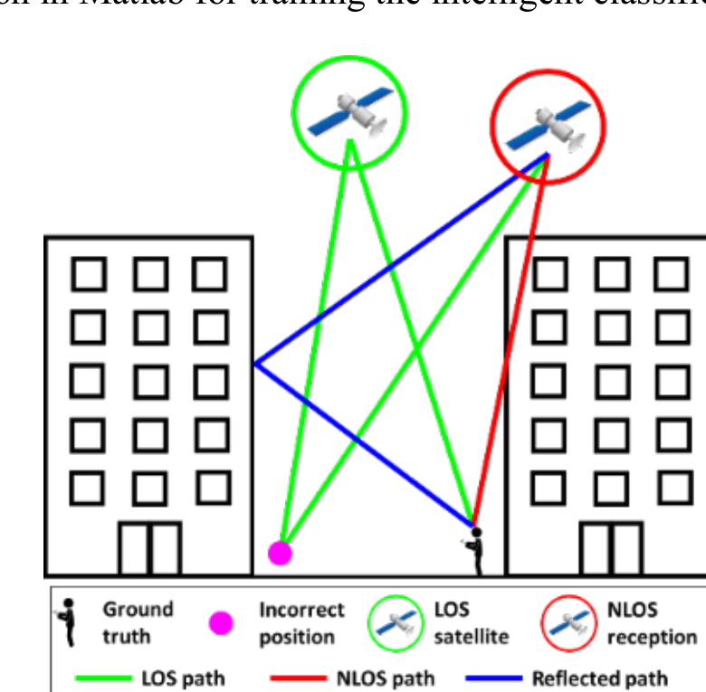
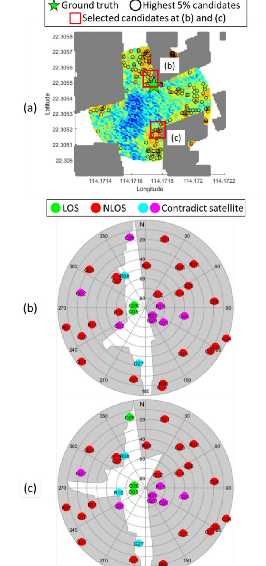
This example motivates the robust method by showing how NLOS reception can make opposite-side street candidates look similarly plausible.
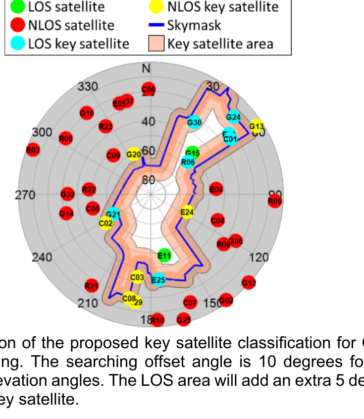
After the basic shadow-matching flow, the reliability rules focus on key satellites near building edges to judge whether the geometry is distinctive enough.
The evaluation then applies those rules across real streets with different building geometries and receiver types.
This diagnostic case shows why ambiguity remains when multiple candidate locations produce similar skymask evidence.
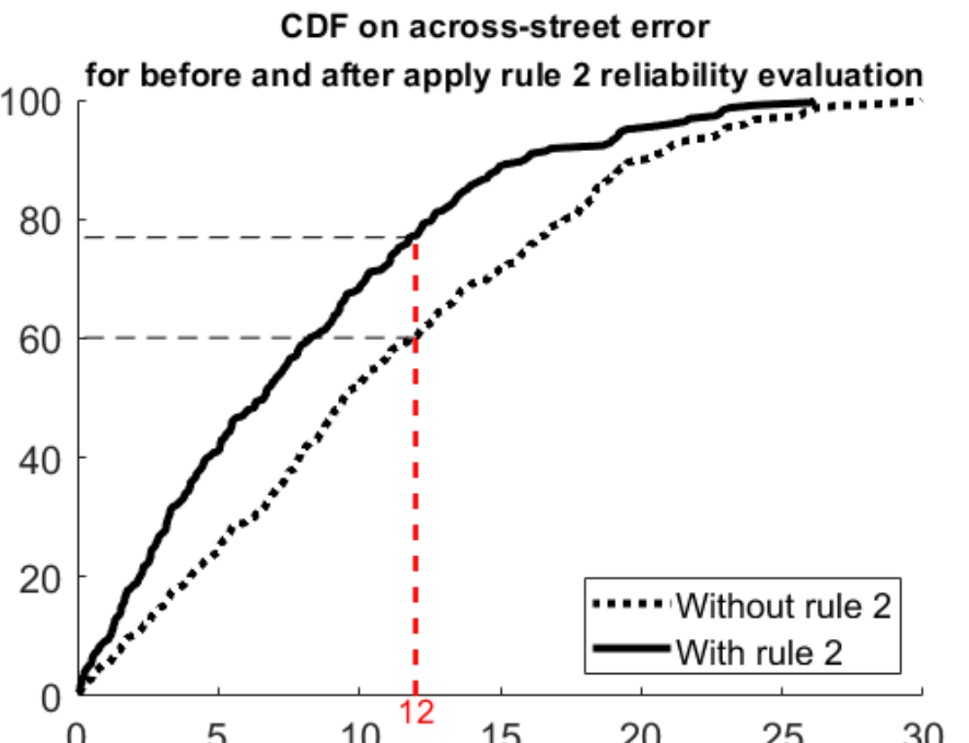
The final result shows how excluding unreliable shadow-matching epochs improves the across-street error distribution.
Key idea. Shadow matching positions a receiver by comparing which satellites are visible against a 3D building model — strong exactly where ranging is weak (cross-street). This paper makes the method robust enough for smartphone-grade signals and noisy visibility decisions.
Impact. A step toward consumer-device urban positioning, feeding directly into the lab’s smartphone-positioning programme and the long-running Huawei collaboration.